DRONE METHODS: PSYCHOGEOGRAPHY
Drone Mapping, 2017


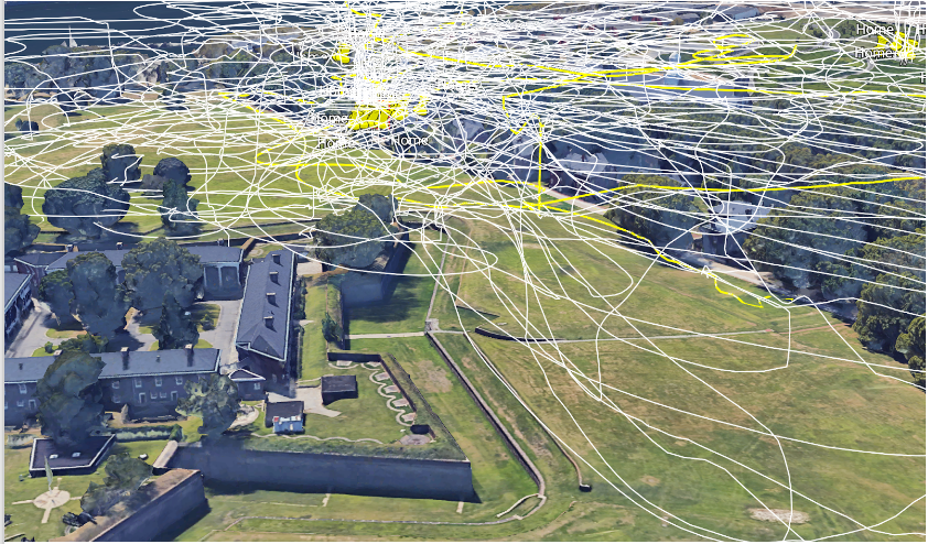
My use of the drone traces the psychogeography of aerial space: of the interaction between terrestrial and vertical geographies. For instance the accumulation of GPS traces over abandoned buildings and tree canopies here speaks as to a paranoia of the drones conspicuousness from the ground. The glut of tracks between the derelict Fort Jay, Castle Williams and connective Colonel’s Row speaks of both a fascination with the textural quality of these ruined spaces, but also, their lack of police and security patrols.
This space adjoins the algorithmic geofence which divides Governors Island: an invisible no-fly zone that supposedly separates drones from the numerous helicopter pads of Wall street. Such divisions remind us that drones are an emerging player in the aerial life of New York city, a place well versed in the power relations of verticality.
Through my research-led practice, I am interested in gestures which acknowledge the complex entanglement of media art and military visualisation. Through my work, I explore the conditions of visibility, orientation and disorientation that span military and aesthetic fields of enquiry.